

Social media are filled with pictures and videos of residents of Delhi-NCR stranded on flooded streets in waist-deep water, swanky cars submerged in floodwater and sewage water entering homes.
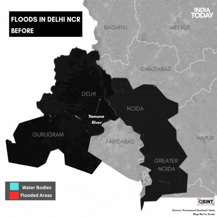
While the floods in Delhi are largely due to the overflowing Yamuna river, the plight of Gurugram residents has been blamed on poor drainage and stormwater management. In Delhi, the Yamuna reportedly swelled to its third-highest mark in six decades. The river’s water level remained above the danger level on Thursday.
Images captured by Sentinel-1 satellite images show the river has swollen beyond its embankments in certain areas, spreading more than seven kilometres on either side. People living in low-lying areas have reportedly been rescued and shifted to safer places.
An analysis of the satellite images shows areas of Geeta Colony, Mayur Vihar Phase I, Yamuna Bazar, Ring Road (towards Wazirabad), Civil Lines, Sonia Vihar, Kashmiri Gate, Bawana (JJ Colony), Mukundpur, Sarita Vihar, and Janakpuri are likely inundated due to the Yamuna River’s overflow.
The water level of the Yamuna river declined to 207.47m at the Old Railway Bridge at 8 am on Thursday morning. However, despite the decline in the river’s water level in the capital, the Yamuna river continues to flow above the danger mark of 205.33m. Yesterday, due to heavy rain, the Yamuna water level recorded an all-time high of 208.66 metres.
In Yamuna Bazar, people evacuated from the low-lying regions to safer places while navigating knee-deep water.
The India Meteorological Department reported light to moderate rain, with thunderstorms, lightning and gusty winds (30–40 km/h), across Delhi, the entire National Capital Region (including Gurugram, Noida, Faridabad and Ghaziabad) and parts of Haryana (Yamunanagar, Kurukshetra, Rohtak and Jhajjar) from September 1 to 3, 2025. Heavy to very heavy rain (64.5–204.4 mm) persisted on September 3 in parts of Haryana, Punjab and the western Himalayan region before easing, worsening waterlogging and flood risk in low-lying areas.
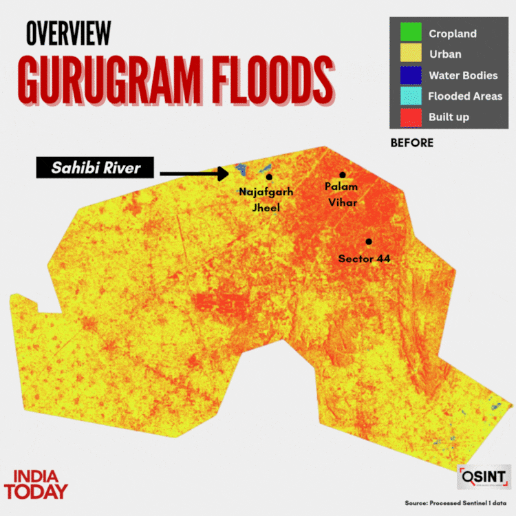
On Monday, a brief but intense downpour—100 mm in four hours—choked NH-48 with gridlock in Gurugram, flooded streets and brought life to a standstill in the so-called “Millennium City.” Satellite imagery showed flooding near Palam, parts of Udyog Vihar and around the Najafgarh Jheel to the north.
– Ends